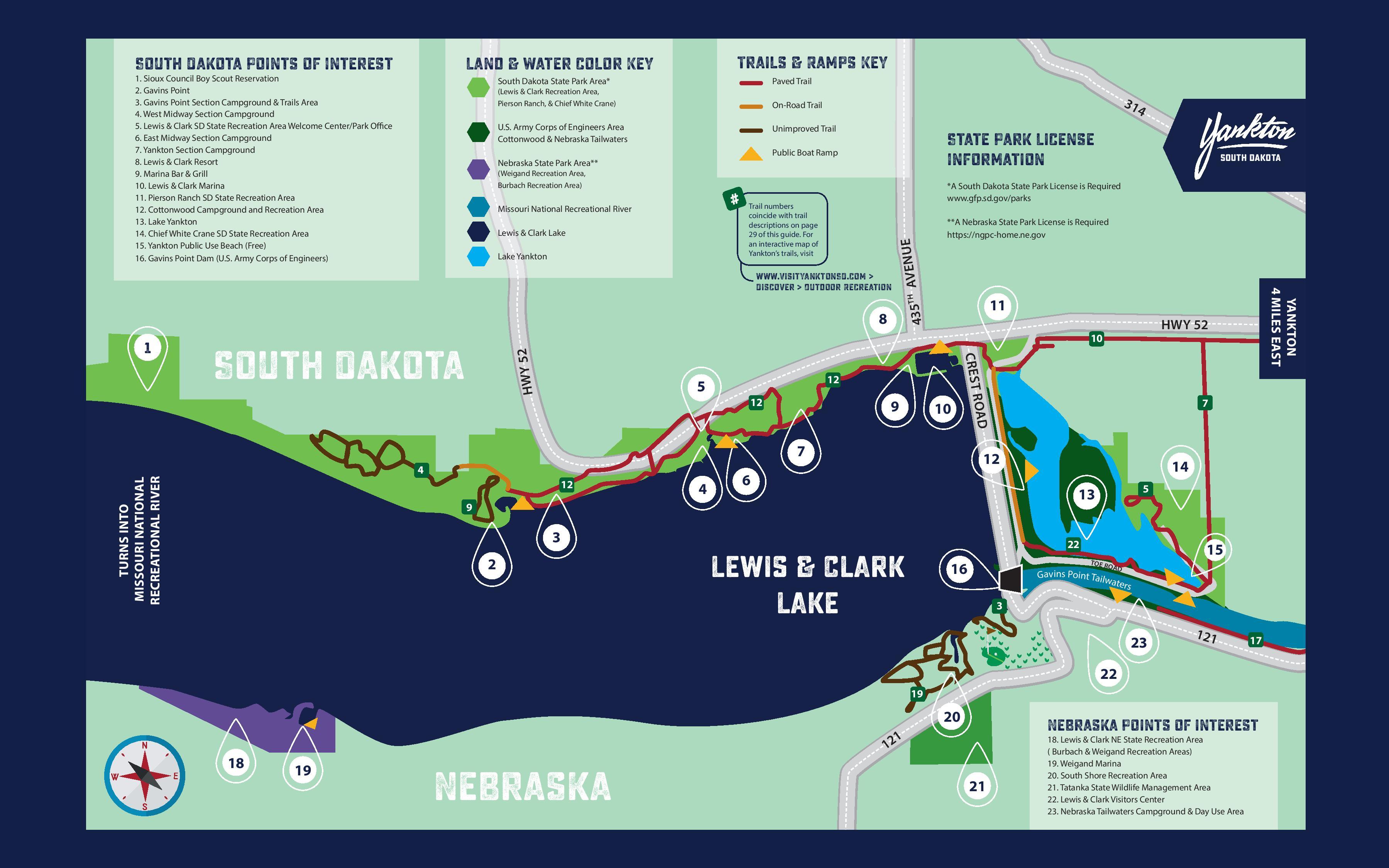
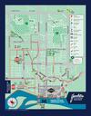
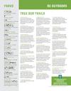
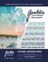
South Dakota Points of Interest
Trails & Ramps Key
Land & Water color Key
1. Sioux Council Boy Scout Reservation
2. Gavins Point
3. Gavins Point Section Campground & Trails Area
4. West Midway Section Campground
5. Lewis & Clark SD State Recreation Area Welcome Center/Park Office
6. East Midway Section Campground
7. Yankton Section Campground
8. Lewis & Clark Resort
9. Marina Bar & Grill
10. Lewis & Clark Marina
11. Pierson Ranch SD State Recreation Area
12. Cottonwood Campground and Recreation Area
13. Lake Yankton
14. Chief White Crane SD State Recreation Area
15. Yankton Public Use Beach (Free)
16. Gavins Point Dam (U.S. Army Corps of Engineers)
Paved Trail
South Dakota State Park Area*
(Lewis & Clark Recreation Area,
31
Pierson Ranch, & Chief White Crane)
On-Road Trail
U.S. Army Corps of Engineers Area
Cottonwood & Nebraska Tailwaters
Unimproved Trail
4
State Park License
Information
Public Boat Ramp
Nebraska State Park Area**
(Weigand Recreation Area,
Burbach Recreation Area)
Missouri National Recreational River
Lewis & Clark Lake
Lake Yankton
*A South Dakota State Park License is Required
www.gfp.sd.gov/parks
Trail numbers
coincide with trail
descriptions on page
29 of this guide. For
an interactive map of
Yankton’s trails, visit
TH
**A Nebraska State Park License is Required
https://ngpc-home.ne.gov
12
5
12
9
10
7
4
12
4
R OA D
HWY 52
South Dakota
TURNS INTO
MISSOURI NATIONAL
RECREATIONAL RIVER
HWY 52
10
CREST
1
11
435
8
7
12
6
14
5
13
9
3
2
YANKTON
4 MILES EAST
www.VisitYanktonSD.com >
Discover > Outdoor Recreation
AVENUE
#
South Dakota
22
Lewis & Clark
Lake
TOE R
O
16
15
AD
Gavins Point Tailw
aters
3
23
121
17
22
19
20
18
Nebraska Points of interest
1
12
19
Nebraska
21
18. Lewis & Clark NE State Recreation Area
( Burbach & Weigand Recreation Areas)
19. Weigand Marina
20. South Shore Recreation Area
21. Tatanka State Wildlife Management Area
22. Lewis & Clark Visitors Center
23. Nebraska Tailwaters Campground & Day Use Area
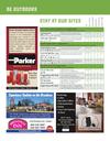
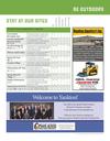
2 | Yankton Visitors Guide | www.VisitYanktonSD.com


 Previous Page