Parks
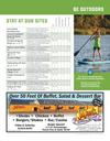
be outdoors
Augusta Park
2901 Fox Run Pkwy. | 1 Acre Park
Aviation Park
East 31st St. | 4 Acre Park
Crockett Park
11th St. & Pennsylvania St. | 0.5 Acre Park
Fantle Memorial Park
21st St. & Douglas Ave. | 18.5 Acre Park
Fox Run Park
2810 Adkins Dr. | 3 Acre Park
Marne Creek West Greenway
West City Limits Rd. | 13.5 Acre Park
Meridian Bridge Plaza
Walnut St. S. of 2nd St. | 1 Acre Park
Morgen Park
11th St. & Green St. | 3 Acre Park
Ridgeway Park
29th St. & Ruth St. | 1.4 Acre Park
Riverside Park
Douglas Ave. & Levee St. | 32 Acre Park
Rotary Nature Area
7th St. & Burleigh St. | 5.5 Acre Park
Sertoma Park
15th St. & Ferdig St. | 28 Acre Park
Summit Activities Center
1801 Summit St. | 78 Acre Park
Tripp Park
8th St. & Broadway Ave. | 2 Acre Park
Water Works Park
Levee St. & Walnut St. | 6 Acre Park
Westside Park
5th St. & Summit St. | 10.5 Acre Park
Yankton Municipal Cemetery
25th St. & Douglas Ave. | 15.25 Acres
trek our trails
1. Arboretum Trail
The Arboretum Trail follows the
perimeter of the Yankton High School
and the Summit Activities Center located
at 1801 Summit Street. 1.4 miles, 8’ wide
asphalt, flat grade on north half, incline
on south half.
2. Auld-Brokaw Trail
The Auld-Brokaw Trail parallels Marne
Creek through the heart of Yankton. 2.75
miles, 10’ wide concrete (Trailhead near
Yankton Chamber & Visitors Center to
Summit Street), moderate grade with a
few slopes exceeding five percent.
3. Calumet Bluff Trail
.9 miles, 8’ wide primitive dirt surface,
varied grade with some steep inclines.
This trail, which is located next to the
Crofton Golf Course on Highway 121, is
an “out and back” trail, meaning hikers
will have to backtrack to the starting point
making the total hike 1.8 miles.
4. Chalk Bluffs Multi-Use Trail
4.1 miles, crushed asphalt surface, varied
grade including moderate to fairly steep
inclines. Great for equestrian riders,
hikers and mountain bikers.
5. Chief White Crane Trail
1 mile, 9’ wide crushed asphalt surface,
flat grade. This trail connects with Deer
Boulevard Trail.
6. Deer Boulevard Trail
1.9 miles, 10’ wide, crushed asphalt
surface, flat grade. This trail connects with
Chief White Crane Trail and Lewis &
Clark Lake Trail.
10. James River Trail
The primitive and scenic trail continues
from East 8th Street out to the James
River and has various grades, including
moderate to fairly steep inclines.
4.3 miles, 5’ wide, paved only one mile
and flat from Rotary Park along East 7th
Street, Highway 50, Ferdig Avenue and
East 8th Street.
11. Lewis & Clark Lake Trail
6.9 miles, including loops, 8’ wide
asphalt, flat grade. This scenic trail winds
from the Pierson Ranch Recreation
Area and throughout the Lewis & Clark
Recreation Area.
12. Majestic Bluffs Trail
Located near the Majestic Bluffs living
community at 2111 W. 11th Street, this
half-mile trail provides a paved stroll
with a view of the countryside, pond,
and twin fountains. .5 miles, 10’ wide
concrete, flat grade.
13. Marne Creek West Greenway Trail
This trail leads from Marne Creek West
Greenway, home to the community
gardens and dog park and located along
West City Limits Road, to the on-street
trail of 23rd Street. .25 miles, 8’ wide
crushed concrete, slight slope.
14. Meridian Bridge Trail
This trail is the historic double-deck
Meridian Bridge, which had its dedication
ceremony on October 11, 1924. The
bridge spans the Missouri National
9. Highway 52 Trail
Paralleling Highway 52 from West City
Limits Road to the National Fish Hatchery
and Aquarium, this section connects
the city trail system to trails found along
Lewis & Clark Lake. 3.14 miles, 8’ wide
asphalt, flat with one moderate incline
exceeding 5%.
15. Nebraska Meridian Trail
1.2 miles, 10’ wide asphalt, flat to
moderate grades. This begins east of
Gavins Point Dam and runs along the
Missouri River and Highway 121 to
Murdo’s Restaurant in Aten, NE.
16. Nebraska Primitive Trail
1 mile, 8’ wide primitive dirt surface,
mostly flat grade with a few steep inclines.
This hiking/biking trail is located on
the south side of the Meridian Bridge
(parking adjacent). Signage will guide you
to the trail access points.
View more
details and an
interactive map
of our trails at
www.cityofyankton.org
under the
“Have Fun” section.
Serving The Healthcare Needs Of The Yankton Area Since 1923
Personal
Service
7. Fantle Memorial Park Trail
Located along Douglas Avenue and
Mulberry Street between 19th Street
and 21st Street. 1 mile around perimeter
of park with additional interior trails,
perimeter is 6’ wide concrete, interior
trails are 8’ wide asphalt, flat grade.
8. Gavins Point Nature Trail
1.2 miles, hiking trail, natural wood chip
and dirt surface.
Recreational River, which is a National
Park. .5 miles each level, 12’ concrete, no
slope on lower level, steep slope on upper
level entry ramps.
We Know You
By Name!
•
•
•
•
Full Service Pharmacy
Durable Medical Equipment
Immunizations
Medicare Part D Counseling
We go the extra mile
to ensure you receive
hometown customer
service, by providing you
and your family with the
service you deserve.
• FREE Prescription Delivery
within Yankton City Limits
• MED–Paks
Medication Management
Yankton Meridian District
109 W. 3rd St., Yankton, SD
605-665-7865 • 1-800-377-6337
www.yanktonrexall.com
Michael
www.VisitYanktonSD.com | Yankton Visitors Guide | 35


 Previous Page